Mountain Passes
TripCheck mountain pass pages bring together road weather reports, snow zone information, mapped cameras, and weather station observations in one place.
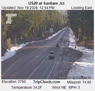
Santiam Pass
Central Cascades pass conditions near the Santiam Pass summit between Sisters and the western Cascades.
US20
MP 52.5 to 71.59 · TOMBSTONE
Clear, no precipitation
Spots of Ice
25°F
Carry Chains or Traction Tires
US20
MP 71.59 to 88 · SANTIAM PASS SMT
Clear, no precipitation
Spots of Ice
25°F
Carry Chains or Traction Tires
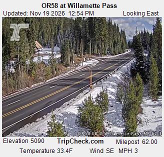
ORE58
MP 48.7 to 69.52 · WILLAMETTE PASS
Clear, no precipitation
Bare Pavement
28°F
Carry Chains or Traction Tires
ORE58
MP 77.42 to 70 · WILLAMETTE PASS EAST
Overcast
Spots of Ice
28°F
Carry Chains or Traction Tires
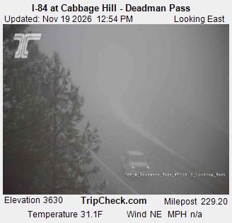
Cabbage Hill / Deadman Pass
Blue Mountains summit travel information for the I-84 Cabbage Hill and Deadman Pass corridor east of Pendleton.
I-84 Eastbound
MP 216 to 226 · CABBAGE HILL EB
Ground Fog
Spots of Ice
34°F
Carry Chains or Traction Tires
I-84 Westbound
MP 250 to 226 · MEACHAM WB
Ground Fog
Spots of Ice
32°F
Carry Chains or Traction Tires
I-84 Eastbound
MP 226 to 250 · MEACHAM EB
Ground Fog
Spots of Ice
32°F
Carry Chains or Traction Tires
I-84 Westbound
MP 226 to 216 · CABBAGE HILL WB
Ground Fog
Spots of Ice
34°F
Carry Chains or Traction Tires
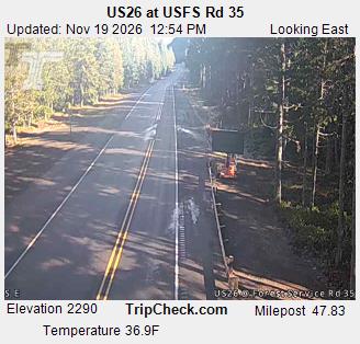
Mt. Hood
Mt. Hood area travel conditions for US 26, OR 35, and OR 173 around Government Camp, Timberline Lodge, Blue Box Pass, Bennett Pass, and White River.
ORE35
MP 68 to 83.55 · PARKDALE
Overcast
Bare Pavement
37°F
Carry Chains or Traction Tires
ORE35
MP 62 to 68 · BENNETT PASS/MT HOOD MEADOWS
Overcast
Spots of Ice
27°F
Carry Chains or Traction Tires
ORE35
MP 60 to 62 · WHITE RIVER
Partly Cloudy
Spots of Ice
29°F
Carry Chains or Traction Tires
ORE173
MP 0.12 to 5.49 · TIMBERLINE LODGE
Partly Cloudy
Packed Snow
22°F
Carry Chains or Traction Tires
US26
MP 42.5 to 60 · GOVERNMENT CAMP
Partly Cloudy
Spots of Ice
31°F
Carry Chains or Traction Tires
US26
MP 59.57 to 67 · BLUE BOX PASS
Overcast
Spots of Ice
32°F
Carry Chains or Traction Tires
US26
MP 67 to 75.5 · WARM SPRINGS JCT
Overcast
Spots of Ice
31°F
Carry Chains or Traction Tires
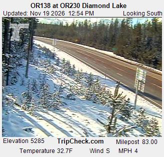
Diamond Lake
Cascade Lakes corridor conditions on OR 138 around Diamond Lake and the north approach to Crater Lake.
ORE138
MP 83 to 100.82 · E DIAMOND LAKE SMT
Overcast
Packed Snow
29°F
Chains Required. Traction tires allowed in place of chains on vehicles under 10,000 GVW and not towing. Vehicles towing must use chains.
(Chain restriction: MP 83 to 93)
ORE138
MP 58 to 83 · TOKETEE
Clear, no precipitation
Spots of Ice
27°F
Carry Chains or Traction Tires
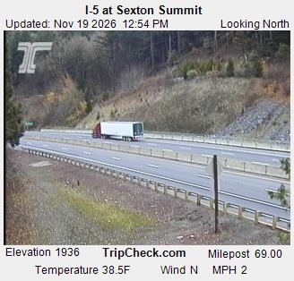
Sexton Pass
Southern Oregon mountain corridor conditions between Grants Pass and Glendale, including Sexton Mountain Pass.
I-5 Southbound
MP 81 to 66 · SEXTON PASS TO STAGE PASS SB
Overcast
Bare Pavement
36°F
Carry Chains or Traction Tires
I-5 Northbound
MP 66 to 81 · SEXTON PASS TO STAGE PASS NB
Overcast
Bare Pavement
36°F
Carry Chains or Traction Tires
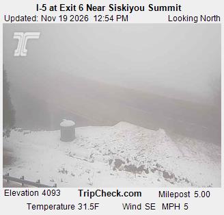
Siskiyou Summit
Southern Oregon / California border summit conditions on I-5 at Siskiyou Summit.
I-5 Northbound
MP 1 to 11 · SISKIYOU SUMMIT NB
Ground Fog
Spots of Ice
31°F
Carry Chains or Traction Tires
I-5 Southbound
MP 11 to 1 · SISKIYOU SUMMIT SB
Ground Fog
Spots of Ice
31°F
Carry Chains or Traction Tires